MASTER CLASSES
The Master Classes will be organized in order to provide general and practical expertise on how to use the most common monitoring systems. Classes will be held by leading international experts.
Each class will cover the following main topics: installation, data acquisition, data processing, tricks&tips from everyday experience. Master Classes will be dedicated to 13 most used monitoring systems. Participants will have the possibility to choose amongst the following lessons (or choose all of them!).
All the classes will have a duration of 4 hours starting from 2.00 pm (GMT+2).
Below you can find the confirmed information on speakers, dates and partners for each Master Class:
Leader
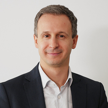
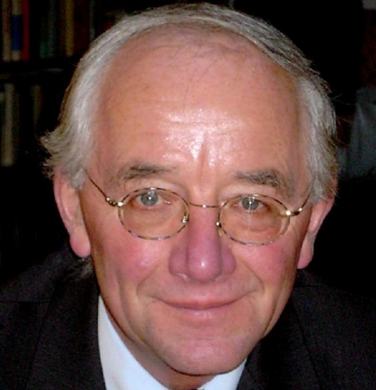
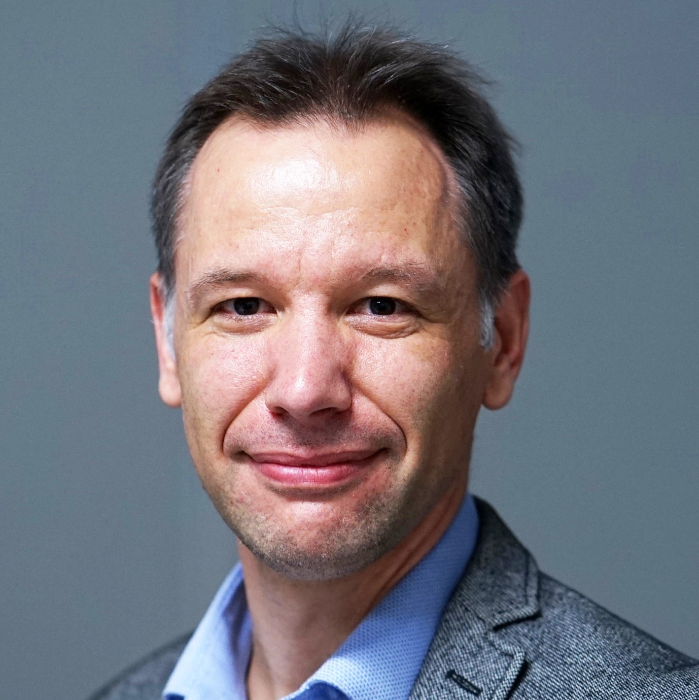
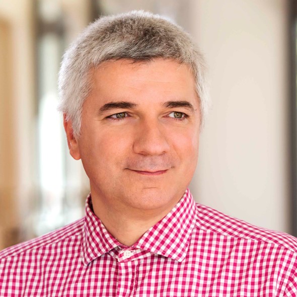
Paolo Mazzanti
Paolo Mazzanti (MSc in Geology and PhD in Earth Sciences) is Professor of Remote Sensing at the Department of Earth Sciences of “Sapienza” University of Rome and Co-founder of NHAZCA S.r.l., Startup Sapienza University of Rome. Paolo is the organizer and scientific leader of several international courses including the annual “International Course on Geotechnical and Structural Monitoring” that, in the last 8 years, attracted more than 700 people from 60 countries and 50 partners.
Paolo is responsible of consulting projects concerning tunnels, oil & gas, dams, open mines, large transportations infrastructures and landslides for National and International firms and agencies, in 10 countries. Paolo is member of the TRB (Transportation Research Board) Engineering Geology Committee and of the informal FMGM (Field Measurement in Geomechanics) committee and associated with several scientific associations (e.g. ISHMII, AIGA).
Paolo tutored and co-tutored more than 30 MSc and PhD theses in Engineering Geology, Civil Engineering and Remote Sensing and has been invited lecturer at several International Universities and Research Centers (e.g. Italy, France, UK, Ireland, Norway, Austria, Germany, USA, Canada, Puerto Rico, Brazil, Hong Kong, Belgium).
Paolo is author of about 100 scientific papers in international journals and conference proceedings concerning the following topics: a) engineering geology (landslides, subsidences, settlements, snow avalanches); b) geological remote sensing; c) geotechnical and structural monitoring; d) monitoring by ground based and satellite radar; e) monitoring of civil structures and infrastructures, including cultural heritages; f) geotechnical assets management.
Saverio Romeo
Saverio Romeo, is a Postdoc Researcher at “Sapienza” University of Rome in the field of geological remote sensing and President of LARES – Italian Union of Civil Protection Experts. He has strong expertise in the Terrestrial SAR Interferometry and emergency response protocols for knowledge, emergency and control monitoring of Geotechnical and Structural Assets. Licensed Engineering Geologist with experience, as technical consultant, at international level on both land and infrastructures projects such as dams, landslide, transportation corridors, etc. He is member of the EGU (European Geoscience Union) and AIGA (Italian Association for Engineering Geology and the Environment). Currently, he is the Senior Manager of the NHAZCA Terrestrial Business & Technical Unit.
Sponsor

Leader
Giorgio Pezzetti
Giorgio is an independent consultant with his Company SMAK s.a.s. since 2015.
He worked for ISMES, an applied research and service centre of ENEL (Italian Electricity Board) for almost 20 years as responsible of the geotechnical and structural monitoring units, being involved in many large and critical projects for dams, tunnels, landslides, bridges, foundations, hydrometeorological and environmental projects all over the world.
In 2000 he established FIELD, where he served as Technical Director till 2014, continuing his activity of system design, field assistance and data evaluation and management.
Giorgio is a member of ISO TC 182/WG2, which is responsible for drafting European Standards on Geotechnical Monitoring and is vice chair of ISSMGE TC220 Field Monitoring.
Sponsor


Leader
Jean Hutchinson
D. Jean Hutchinson is a Professor of Geological Engineering at Queen’s University, Kingston, Canada, and served as the Head of Department between 2009 and 2017. A registered Professional Engineer in Ontario, Jean conducts research on the assessment and mitigation of geomechanics risks related to rock slopes and ground surface subsidence, with a view to developing decision support systems founded on data collected from a variety of collection and monitoring techniques, always considering geological models and mechanics. Jean advocates for and participates in experiential learning, including field based education, and the promotion of inclusivity and diversity in STEM subjects.
Dr. Hutchinson is the Vice President for North America for the IAEG (2018 to 2022) and is President of the Board for the Canadian Foundation for Geotechnique.
Jean has had the great pleasure to supervise over 40 graduate students, and to teach a wide variety of courses to several 1000s of undergraduate students. Dr. Hutchinson in collaboration with her students, as well as numerous research partners, has published 1 book, 9 book chapters, 60+ refereed journal papers, 90 full length refereed conference papers and 80 extended abstracts / non-refereed conference papers.
Dr. Hutchinson has been very fortunate to receive a number of awards, including most recently the Glossop Medal and Lecture from the Geological Society of the UK in 2019, the Canadian Pacific Railway Medal from the Engineering Institute of Canada (2017), the T. Geoffrey Flynn Advancement Champion Award from Queen’s University (2017), the inaugural Excellence in Engineering Education award, from the Faculty of Engineering and Applied Science at Queen’s University (2016) and the Robert L. Schuster Medal, jointly awarded by the American Association of Environmental & Engineering Geologists and the Canadian Geotechnical Society (2016). Jean was also pleased to be named as one of 12 “First Women in Canadian Geotechnique”, by the Canadian Geotechnical Heritage Committee in 2018. In recognition of her work, Jean has been elected a Fellow of the Canadian Academy of Engineering and the Engineering Institute of Canada.
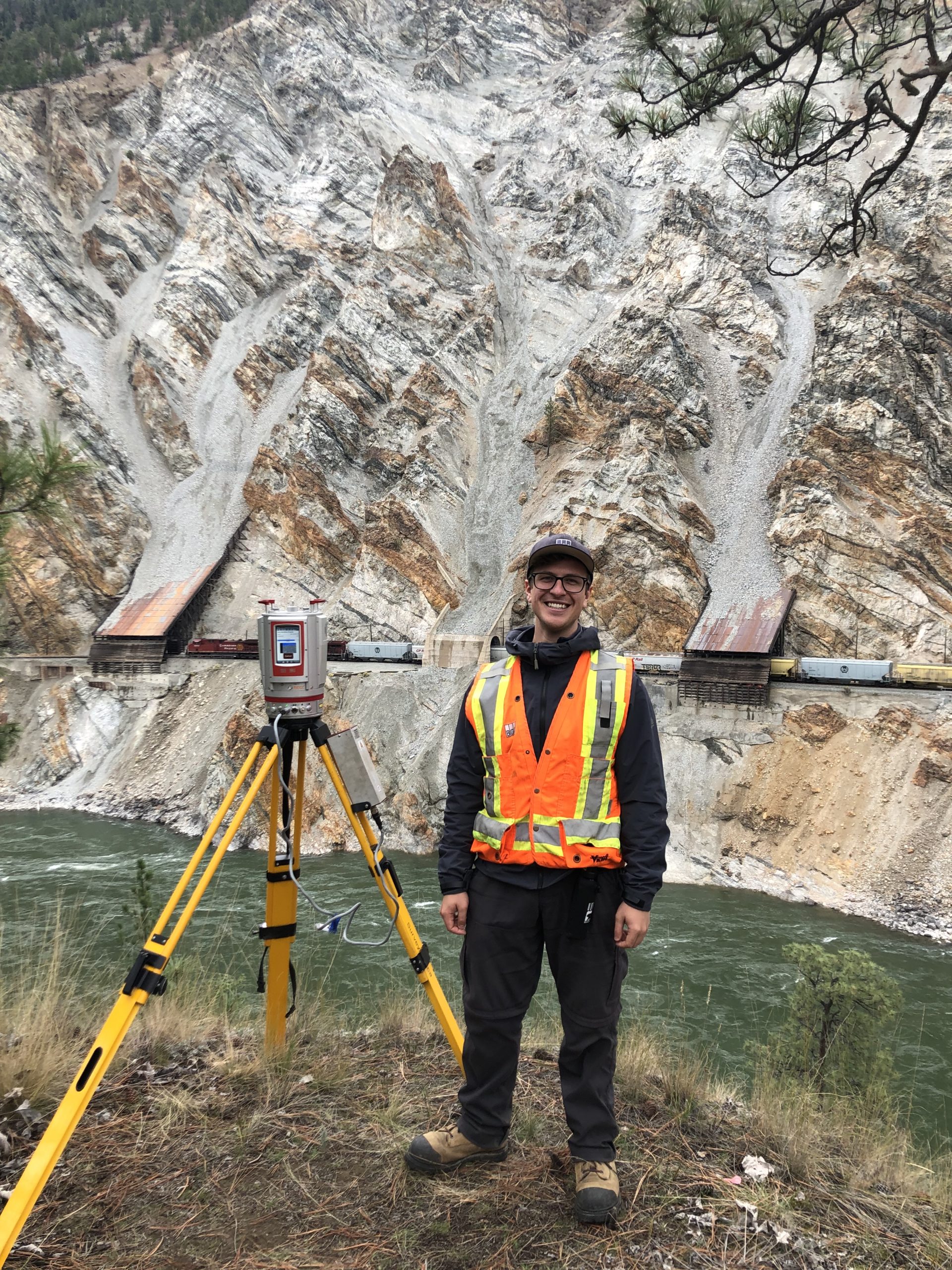
David A. Bonneau
David A. Bonneau is a PhD candidate in geological engineering at Queen’s University under the supervision of Drs. D. Jean Hutchinson and Scott McDougall (UBC). His research is part of the Canadian Railway Ground Hazard Research Program and focuses on the application of remote sensing for the characterization of debris transfer processes.
Paul-Mark DiFrancesco
DiFrancesco is a PhD student studying at Queen’s University, Kingston, Canada, under the supervision of Dr. Jean Hutchinson and Rob Harrap. He recently completed a Master of Applied Science degree in Geological Engineering. His research has focused on using terrestrial laser scanners to monitor rock slope failures – mainly by extracting and computing 3D rockfall information from sequential datasets. His current work is focused on the simulation and visualization of dynamic earth surface processes using game engine tools.
Sponsor

Leader
Francesco Mancini
Francesco Mancini received his M.Sc. degrees in marine environmental sciences and a Ph.D. in surveying and mapping from the University of Bologna, Italy. Since 20 years, he works in the field of geomatics, as researcher (Technical University of Bari, Italy), associate professor (University of Modena and Reggio Emilia, Italy) and surveyor in application to ground deformation, natural hazard assessment and landscape archaeology. He is professor in Geomatics technology, GIS, Cartography and Photogrammetry at schools of Civil and Environmental Engineering. Francesco is at head of the Laboratory of Geomatics Engineering and associate editor of Applied Geomatics Journal /Springer).
Since 1998, he was involved in the application of space geodesy and remote sensing to the environmental monitoring and glaciology in Antarctica. Took part to five Antarctic Expedition, spanning from 1998 to 2005, as surveyor by global navigation satellite systems (GNSS) for crustal deformation, geodynamics and ice sheet monitoring. Since 2002 his researches and professional activities were focused on application of GNSS and satellite high resolution imagery for environmental monitoring and integrated use of survey methodologies for different purposes. Precise GNSS and topographic surveys were also managed during several and repeated archaeological expeditions worldwide. He used GNSS for many applications including coastal monitoring, risk assessment to ground deformation phenomena and slope failures.
In the last years, he focused on the design and validation of surveying methodologies for monitoring applications in the field of civil and environmental engineering with related processing strategies and data management. Research activities are now focused on topics related to the impact of innovative and emerging technologies on the surveying/monitoring activities using approaches based on the integration of GNSS, terrestrial laser scanner and aerial photogrammetry using drones.
Leader
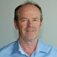
Helmut Bock
Geotechnical Consultant, Bad Bentheim, Germany.
From 1989 to 1997 he was President of Interfels GmbH, Bad Bentheim, providing geotechnical instrumentation products and field services. Previously he was Professor of Geomechanics at James Cook University in Townsville, Australia. He has been involved in in-situ rock testing methods and geotechnical instrumentation for more than 30 years, and has numerous publications and patents.
Helmut is a member of ISO TC 182/WG2, which is responsible for drafting International Standards on Geotechnical Monitoring
Holger Wörsching
Holger Wörsching, born in 1975, studied civil engineering at the University of Karlsruhe and then worked as a research assistant at the Institute for Soil and Rock Mechanics at the University of Karlsruhe. In 2006 he changed to Solexperts AG in Switzerland and has been responsible for numerous in situ tests as well as geotechnical instrumentation and monitoring projects in Europe and South Africa. He is currently the Swiss delegate of ISO TC-182 / WG2 Geotechnical Monitoring.
Sponsor

Leader
Giorgio Pezzetti
Giorgio is an independent consultant with his Company SMAK s.a.s. since 2015.
He worked for ISMES, an applied research and service centre of ENEL (Italian Electricity Board) for almost 20 years as responsible of the geotechnical and structural monitoring units, being involved in many large and critical projects for dams, tunnels, landslides, bridges, foundations, hydrometeorological and environmental projects all over the world.
In 2000 he established FIELD, where he served as Technical Director till 2014, continuing his activity of system design, field assistance and data evaluation and management.
Giorgio is a member of ISO TC 182/WG2, which is responsible for drafting European Standards on Geotechnical Monitoring and is vice chair of ISSMGE TC220 Field Monitoring.
Georgette Hlepas
Dr. Hlepas leads the US Army Corps of Engineers (USACE) Geotechnical, Geology, and Materials Community of Practice and is the proponent for USACE Instrumentation and Performance Monitoring. She has 17 years of experience working as a geotechnical engineering on a variety of large projects including dams, levees, and confined disposal facilities. Dr. Hlepas has focused much of her career on advancing the instrumentation and performance monitoring state-of-practice including updating engineering guidance, performing reviews of Instrumentation and Monitoring Programs, and leading the effort to implement an enterprise-level instrumentation data management system. She has developed and taught multiple instrumentation and performance monitoring courses and workshops and has authored numerous papers on both geotechnical investigations and instrumentation topics.
Dr. Hlepas was the chairperson the US Society of Dams (USSD) Monitoring of Dams and Their Foundations Committee for several years and is a member of multiple professional organizations. She has a master’s degree in civil engineering from Columbia University in New York, a doctorate degree in civil engineering from the University of Illinois at Chicago and is a licensed Professional Engineer in the state of Illinois.
Sponsor

Leader
Werner Lienhart
Werner Lienhart is Full Professor and Head of the Institute of Engineering Geodesy and Measurement Systems (IGMS) at Graz University of Technology, Austria. Prior to this position, he was Product Manager Innovation at Leica Geosystems at the Headquarter in Switzerland.
He has more than 20 years of experience in the monitoring of civil engineering structures using geodetic, geotechnical and fibre optic sensors. Prof. Lienhart has published more than 140 papers and holds several patents. He is President of the Austrian Geodetic Commission (OeGK) and President of the International Society for Structural Health Monitoring of Intelligent Infrastructure (ISHMII).
Furthermore, Prof. Lienhart is co-founder of ACI Monitoring, a company specialized in fibre optic sensing in civil engineering and geotechnical applications.
Sponsor


Leader
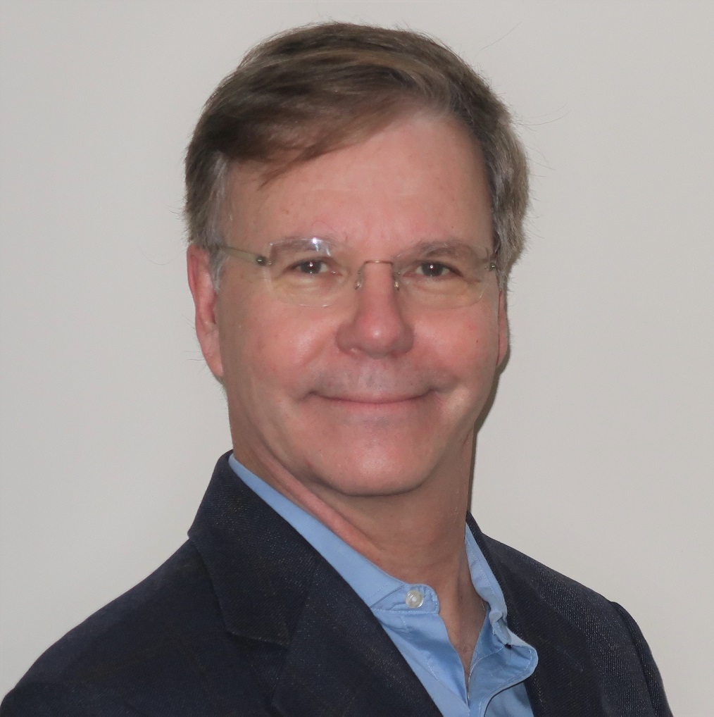
Daniel Naterop
Graduated in 1978 in Civil Engineering at the Technical University Rapperswil, Switzerland, Daniel participated in large infrastructure civil engineering projects (Tunnels, pipelines, large structures).
After working in one of the leading Swiss contractor for special civil engineering (exploration drilling, ground anchors, grouting, foundation engineering), Daniel worked for Solexperts AG, Switzerland for over 30 years. There, he was manager of the department of geotechnical monitoring and project responsible for the development of different monitoring systems for the GeoMonitor, automatic data acquisition and monitoring system, and for, the web-based data visualisation WebDAVIS.
Since 2013, Daniel is Sisgeo’s area manager for Northern Europe. In this position, he acts as project manager and consultant for geotechnical monitoring projects actually for Germany, Austria, Netherlands and Switzerland. Daniel is also in technical support to the Sisgeo-group for research and development of systems and system application of borehole instrumentation.
From 2018 until 2019 Daniel was CEO of Huggenberger AG, the Swiss company within the Sisgeo-group specialized in concrete dam monitoring. Now, due to the succession of his position, he works as senior advisor and project manager for both companies, Huggenberger AG and Sisgeo.
Daniel was and currently is lecturer for geotechnical instrumentation at seminars, conferences, courses and workshops around the world and has published more than 30 scientific papers.
Sponsor

Leader
Erol Kalkan
Dr. Kalkan received his B.Sc. degree in Civil Engineering and first M.Sc. degree in Engineering Seismology. His second M.Sc. degree in Structural Engineering.
His doctorate is in Structural and Geotechnical Engineering from UC Davis. His postdoctoral studies were conducted at the UC Berkeley in collaboration with Prof. Anil Chopra.
Dr. Kalkan was the recipient of the “2008 ASCE Raymond C. Reese Research Prize in Structural Engineering”. He has been granted the “2008 EERI-FEMA NEHRP Professional Fellowship in Earthquake Hazard Reduction”.
He authored and co-authored more than 120 publications in earthquake engineering.
Dr. Kalkan served as a guest editor of five special journal issues. He is currently acting as an associate editor for ASCE Journal of Structural Engineering, Engineering Structures, and Seismological Research Letters.
After working for 11 years for the United States Geological Survey as a research structural engineer and national strong-motion network manager, he founded QUAKELOGIC in northern California.
Sponsor


Leader
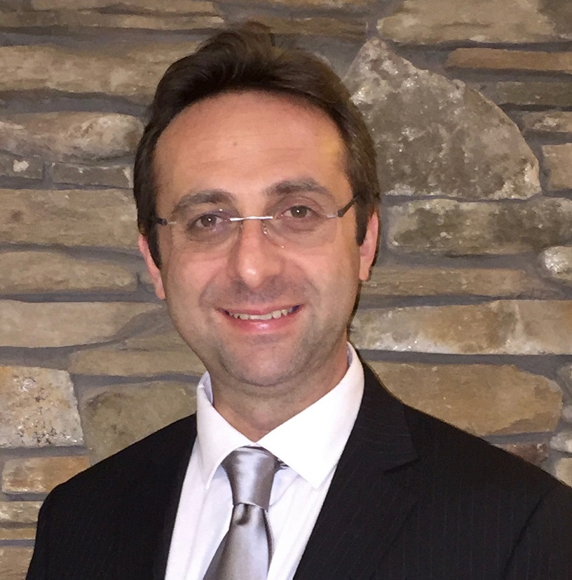
Pierre Choquet
Pierre Choquet has been involved in the field of Geotechnical Instrumentation and Monitoring for most of his career. He joined RST Instruments of Vancouver, BC in early 2007 and is now Technical Advisor and Vice-President of Market Development. Prior to this, he worked between 1994 and 2006 at two other manufacturing firms of geotechnical and structural instruments and data acquisition systems. Pierre graduated in 1978 in Geological Engineering (Engineering Geology) from Ecole Polytechnique in Montreal and subsequently obtained a doctorate degree in Rock Mechanics from Ecole des Mines de Paris in France. From 1982 to 1993 he was a faculty member at the department of Mining and Metallurgy of Laval University in Quebec City where his specialty was rock mechanics, ground control, and applied geology.
Over the years, Pierre has been involved in numerous geotechnical, mining and dam monitoring instrumentation projects in North America and overseas and he has authored several technical papers on rock mechanics and geotechnical instrumentation subjects. He has also conducted several short courses and workshop and serves on Technical Committees of a number of professional organizations including ICOLD, USSD, ASCE, CGS and ISSMGE. Pierre is also the recently appointed Editor of the Instrumentation and Monitoring column of the Canadian Geotechnique magazine.
Sponsor
Leader
Paolo Mazzanti
Paolo Mazzanti (MSc in Geology and PhD in Earth Sciences) is Professor of Remote Sensing at the Department of Earth Sciences of “Sapienza” University of Rome and Co-founder of NHAZCA S.r.l., Startup Sapienza University of Rome. Paolo is the organizer and scientific leader of several international courses including the annual “International Course on Geotechnical and Structural Monitoring” that, in the last 8 years, attracted more than 700 people from 60 countries and 50 partners.
Paolo is responsible of consulting projects concerning tunnels, oil & gas, dams, open mines, large transportations infrastructures and landslides for National and International firms and agencies, in 10 countries. Paolo is member of the TRB (Transportation Research Board) Engineering Geology Committee and of the informal FMGM (Field Measurement in Geomechanics) committee and associated with several scientific associations (e.g. ISHMII, AIGA).
Paolo tutored and co-tutored more than 30 MSc and PhD theses in Engineering Geology, Civil Engineering and Remote Sensing and has been invited lecturer at several International Universities and Research Centers (e.g. Italy, France, UK, Ireland, Norway, Austria, Germany, USA, Canada, Puerto Rico, Brazil, Hong Kong, Belgium).
Paolo is author of about 100 scientific papers in international journals and conference proceedings concerning the following topics: a) engineering geology (landslides, subsidences, settlements, snow avalanches); b) geological remote sensing; c) geotechnical and structural monitoring; d) monitoring by ground based and satellite radar; e) monitoring of civil structures and infrastructures, including cultural heritages; f) geotechnical assets management.
Sponsor
Leader
Branko Glišić
Prof. Branko Glišić, received his degrees in Civil Engineering and Theoretical Mathematics at the University of Belgrade, Serbia, and Ph.D. at the EPFL, Switzerland. After eight-year experience at SMARTEC, Switzerland, where he was involved in numerous Structural Health Monitoring (SHM) projects, he has been employed as a faculty member at the Department of Civil and Environmental Engineering of Princeton University, where he is currently serving as the Chair. His research is in the areas of SHM, Smart Structures, Heritage Structures, and Engineering and the Arts.
Prof. Glišić’s research includes: long-gauge and distributed fiber optic sensors, 2-D sensors based on large area electronics, and 3-D sensors based on radio-frequency devices and ground penetrating radar; advanced data analysis for diagnostics, prognostics, and decision-making based on structural analysis, machine learning and hybrid physics-informed machine learning; documentation, integration and visualization using virtual tours, information modelling, and augmented reality; smart, kinetic, deployable, and adaptable structures; heritage structures, and engineering and the arts in general. His application domains include concrete, steel, and masonry structures: bridges, buildings, pipelines; smart structures for coastal protection; and historical buildings, monuments, and sites.
Prof. Glišić is author and co-author of 100+ published papers, short courses on SHM, and the book “Fibre Optic Methods for Structural Health Monitoring”. He is Council Member and fellow of ISHMII, voting member of ACI committee 444, and member of several other professional associations and journal editorial boards. Prof. Glišić is recipient of several awards including prestigious SHM Person of the Year Award and ASCE Moisseiff Award.
Daniele Inaudi
Dr. Daniele Inaudi received a degree in physics from the Swiss Federal Institute of Technology in Zurich (ETHZ). In 1997, he obtained his Ph.D. in civil engineering at the IMAC Laboratory of Stress Analysis of the Swiss Federal Institute of Technology in Lausanne. In 2005, he received a Master’s degree in Business Administration from the University of Southern Switzerland. Daniele Inaudi is co-founder of SMARTEC SA and General Manager of Roctest. He is author of more than 200 papers, five book chapters and a book on “Fiber Optic Methods for Structural Health Monitoring”.
Sponsor


Leader
Andrea Zattoni
Andrea Zattoni is a civil engineer. He graduated at Politecnico of Milano. He worked at ISMES from 1991to 1998 in the monitoring department of the Geotechnical Division. Andrea Zattoni has 30 years of experience in monitoring system related to dam safety, structure and hydro-geological hazard in Italy and abroad . He worked in SISGEO for two years and in 2000 he joined Enel.Hydro where he worked as Project Manager for international project till 2004. In 2004 he was hired by CESI SpA in ISMES Division where he assumed the responsibility of Head of monitoring Department and acted as international Project Manager. From 2016 till 2018 he worked as a resident engineer in Rio de Janerio in CESI do Brasil for the ISMES Division of CESI SpA.
At present in CESI SpA, he cover the role as Global Key Account for monitoring system as well as Business Development in Italy for Water and Infrastucture.Main projects which Andrea Zattoni acted as Project Manager are:, Itaipu Dam in Brazil and Paraguay including implementation of an Early Warning System, Khao Laem Dam integrated monitoring system (static, seismic and hdyro-meteorological) in Thailand, Pisa Tower during the recovery tilting project, San Marco Bell Tower in Venice, Giotto Tower Bell in Florence, the structural monitoring system of the Chernobyl Power Unit N. 4 collapsed after the accident in 1986, the Landslide monitoring network along the Black Sea Cost in Bulgaria, hydrometeorological monitoring network to detect the risk of avalanches along the Italian Alps, the Rosone landslide monitoring project.
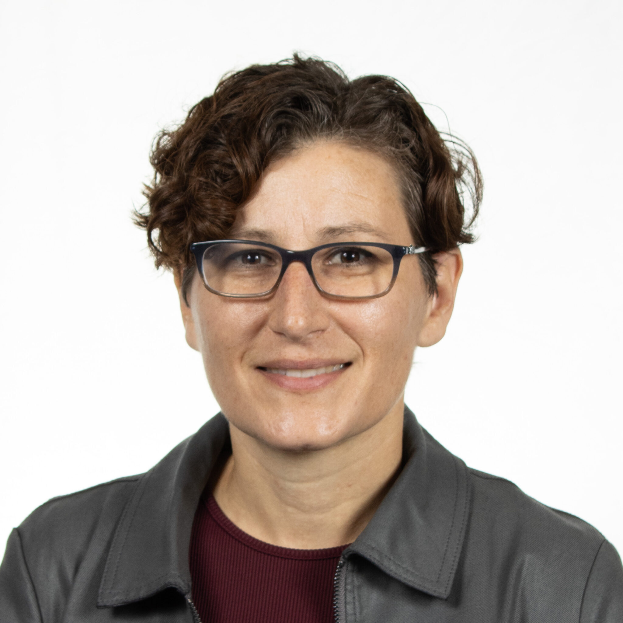
Flavia Ciferri
Flavia Ciferri is an environmental engineer. She graduated at University of Rome “La Sapienza” in 2013 and in the same year she was hired at CESI SpA – ISMES Division.
During the first years she was involved in hydraulic studies concerning dam safety. She was part of the technical team that performed dam break studies and flood analysis.
In 2017 she was CESI technical reference for the development of Road Asset Management System of Anas S.p.A. RAM project deals with a new platform, GIS referenced, aimed at creating a proper analysis and management of data concerning all the road assets.
Since 2019 she joined the monitoring Department of CESI-ISMES. At the present, she acts as Project Manager for design and implementation of automatic monitoring systems. Besides that, she is in charge of managing maintenance contracts related to existing monitoring system for dams, heritage buildings and landslides. One of the most relevant topics of these contracts is data management and data analysis.
Sponsor

Leader
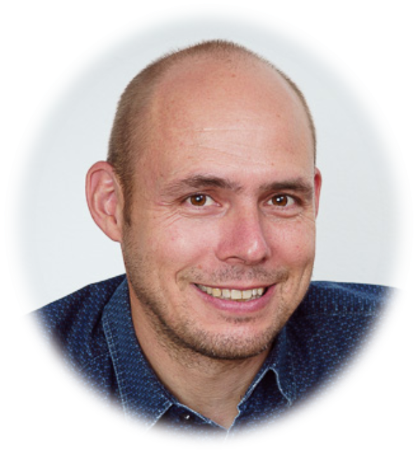
Andrea Manconi
Andrea Manconi is trained as an Environmental Engineer (University of Cagliari, Italy) and received the PhD in Natural Sciences from the University Potsdam, Germany in 2009. He has worked as research scientist first at the Helmholtz Centre of Geosciences GFZ Potsdam, Germany, (2005-2009) and then at the National Research Council, Italy, (2009-2015). Since August 2015 he is senior scientist and lecturer in engineering geology at the ETH Zurich, Department of Earth Sciences (www.engineeringgeology.ethz.ch), and in May 2019 he joined GAMMA Remote Sensing AG (www.gamma-rs.ch) as a scientific collaborator. His activities include monitoring, analysis and modeling of surface deformation due to volcanic and seismic activity, as well as landslide and geo-hydrological phenomena. He holds the habilitation as professor in Engineering Geology and Geophysics.
Paolo Mazzanti
Paolo Mazzanti (MSc in Geology and PhD in Earth Sciences) is Professor of Remote Sensing at the Department of Earth Sciences of “Sapienza” University of Rome and Co-founder of NHAZCA S.r.l., Startup Sapienza University of Rome. Paolo is the organizer and scientific leader of several international courses including the annual “International Course on Geotechnical and Structural Monitoring” that, in the last 8 years, attracted more than 700 people from 60 countries and 50 partners.
Paolo is responsible of consulting projects concerning tunnels, oil & gas, dams, open mines, large transportations infrastructures and landslides for National and International firms and agencies, in 10 countries. Paolo is member of the TRB (Transportation Research Board) Engineering Geology Committee and of the informal FMGM (Field Measurement in Geomechanics) committee and associated with several scientific associations (e.g. ISHMII, AIGA).
Paolo tutored and co-tutored more than 30 MSc and PhD theses in Engineering Geology, Civil Engineering and Remote Sensing and has been invited lecturer at several International Universities and Research Centers (e.g. Italy, France, UK, Ireland, Norway, Austria, Germany, USA, Canada, Puerto Rico, Brazil, Hong Kong, Belgium).
Paolo is author of about 100 scientific papers in international journals and conference proceedings concerning the following topics: a) engineering geology (landslides, subsidences, settlements, snow avalanches); b) geological remote sensing; c) geotechnical and structural monitoring; d) monitoring by ground based and satellite radar; e) monitoring of civil structures and infrastructures, including cultural heritages; f) geotechnical assets management.
SUBSCRIBE TO OUR NEWSLETTER
NHAZCA S.r.l.
VAT Number: 10711191006
REA: RM-1250972
Share Capital: 40.000 €
Univocal Code: W7YVJK9
Registered Office
Via Vittorio Bachelet, 12
00185 Rome (Italy)
Ph.: (+39) 06 95.065.820
Fax: (+39) 06 95.065.823
PEC: nhazcasrl@pec.it
E-mail: info@nhazca.com
Skype: nhazca